

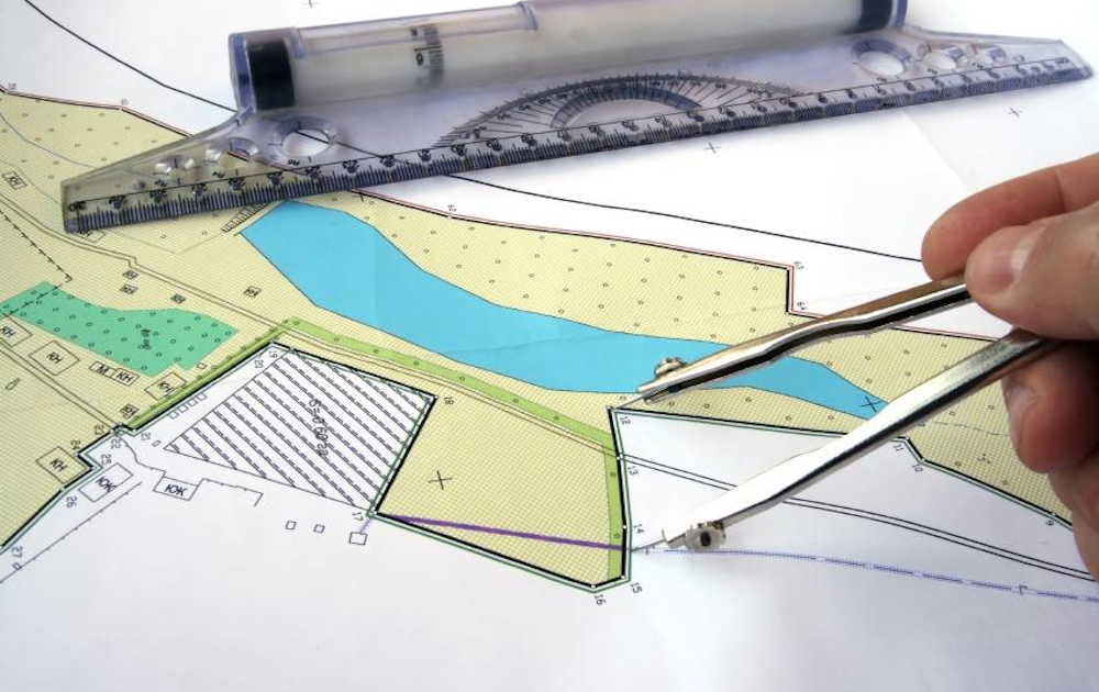
The cadastre and the property register are a system in which all real estate on the territory of the country is arranged and described: land, buildings and independent objects in buildings (apartments, garages, shops, offices and others). The system contains complete and accurate information about the boundaries and location of properties, their main quantitative and qualitative characteristics, legal rights and restrictions on these properties.
Modern trends in the development of cadastral systems and land registration systems are the unification of data in one information system and an increase in the scope of data. The aim is to characterize the full legal status of each object of the cadastre – to make it possible to determine both private rights and public rights and restrictions (protected and disturbed territories, territories with special purpose, etc.).
Each property has an identifier that makes it unique for the country (Example: 07079.659.35). Your property is part of this information system. In order for his data to be correctly reflected in the new digital cadastral map and cadastral register of the relevant settlement, your assistance is also necessary when the map is made.
Creation of cadastral maps and cadastral register

Recommendations to citizens in the open procedure for the creation of a cadastral map and cadastral registers (KKKR) for your locality.
- Every owner of a property, building or separate objects in a building (apartments, garages, shops, offices and others) is obliged to:
а) to provide access to the property to carry out cadastre works;
б) to mark at his own expense with regulated permanent signs the boundaries of the property in accordance with the deed establishing his right of ownership;
в) to provide an employee from the cadastre office or the person/persons from the company selected to prepare the cadastral map all documents and materials certifying his rights to the property.
item 1, letters a, b and c – refer to article 38, paragraph 1, items 1, 2 and 3 of the Law on the Cadastre and Property Register (ZKIR) promulgated/SG, No. 34 of 25.04.2000.
Important for citizens: If it is established that some of the above three obligations have not been complied with by the owner during the procedure for drawing up the KKKR, after the final entry into force of the KKKR, the owner shall pay for all errors and inaccuracies made during the preparation of the KKKR.
In order to create an up-to-date model of a digital cadastral map, geodetic measurements and calculations are performed against a previously created working geodetic base (RGO). The results of geodetic surveys and calculations of coordinates of detailed points are transmitted on paper and magnetic media.
-
RGO – a preliminary project is made – coordination with the AK
-
Field measurements – stabilization of points
-
Transfer of RGO – diagram, coordinate register, benchmark carnets, explanatory note
-
The cadastral map is transmitted on paper at a scale of 1:10,000 and on a digital model
-
Cadastral registers are transmitted on paper and magnetic media (by regions)
-
Data and materials are accepted from the AC and from the Municipality of the settlement where the KKKR will be made: Digital model – if there is one
Regulatory copies of amendments
Correspondence
Regulatory lanes from the Old Cadastral Plan
Ownership documents (notary deeds, partition agreements, etc.)
Record books -
The received materials are arranged and sorted in a convenient order (for example, by neighborhoods)
-
The old plan photograph numbers are compared to which of the current regulatory plan they correspond to
-
Files are sorted and amendments are specified
-
The administrative addresses and numbers of the properties are specified
-
Questionnaires are filled out, taking information directly from the property owners
-
The signatures of the buildings (construction, type) are specified
-
Specifying the ownership of the individual objects in the buildings
-
Contact area: includes the area that covers the properties from the KVS and from the Urbanized Territory
-
KR is created on the basis of existing property documents, floor plans and data on buildings and facilities
-
Schemes of individual objects in buildings
-
Processing of field measurements
Maintenance of cadastral maps and cadastral register
The maintenance of the KKKR is carried out by the regional offices of geodesy, cadastre and cartography (SGKK) in the country, and for all changes the corresponding state fees are paid – tariff No. 14 pron. SG No. 99 of 2001 and no. 99 of 2002
Important for citizens, property owners -it should be known that SGKK only registers the projects made for changes. The projects for changes themselves are carried out by licensed surveyors selected by the owner and then submitted to SGKK for approval, registration and issuance of the relevant order.
Maintenance of KK and KR includes the following activities:
– changing property boundaries and building outlines;
– creation of new cadastre objects;
– completing omissions and correcting errors.
1. When changing the boundaries of the properties and the outlines of the buildings, the owner is obliged to contact a licensed company authorized to carry out this activity and to present all the documentation at his disposal.
After the licensed company has drawn up the project for amending the KKKR, the owner submits the project drawn up by the company to the SGKK and pays the relevant state fees for registration, issuance of a sketch, etc.
For the development of the amendment project, the owner agrees with the licensed company on the cost of the service.
Important for citizens, property owners -In case of any change that affects other properties, SGKK issues an „Act of Incompleteness and Errors“ (Ordinance No. 14/23.07.2001 – Art. 71, Paragraphs 2 and 3), in which it is mandatory to sign the drafter, the applicant and all directly interested owners.
2. When creating new objects on the cadastre, the owner is obliged to contact a licensed company authorized to carry out this activity and present all the documentation at his disposal.
After the licensed company has drawn up the project for amending the KKKR, the owner submits the project drawn up by the company to the SGKK and pays the relevant state fees for registration, issuance of sketches, etc.
For the development of the amendment project, the owner agrees with the licensed company on the cost of the service.
3.Completion of incompleteness and correction of errors in the KKKR.
Important for citizens, property owners – Official corrections in SGKK are carried out when the property owner has fulfilled his obligations under Art. 38, paragraph 1, items 1, 2 and 3 (see above), otherwise the changes and corrections under KKKR remain his account.
When supplementing deficiencies and correcting errors in the KKKR, when the correction is not done in an official way, the owner is obliged to contact a licensed company authorized to carry out this activity and present all the documentation at his disposal.
After the licensed company has drawn up the project for amending the KKKR, the owner submits the project prepared by the company to the SGKK and pays the relevant state fees for registration.
For the development of the amendment project, the owner agrees with the licensed company on the cost of the service.
Regulation
Street and yard regulation is available for the regulated land property (UPI), which is identified on the sketch with a Roman numeral followed by the property’s Arabic numerals.
If there is an effective urban planning procedure for the plot, a visa can be issued. If not, a Working Development Plan (RUP) is drawn up, which is offered for approval, under certain conditions, by the neighbors of the property.
If there are no objections, the RUP enters into force and a visa application should be submitted.
For areas where there is no accepted cadastral map, the regulatory building plan approved by the municipality applies.
Maintenance of regulatory plans is carried out at:
- Changes in street or yard regulation
- Extensions to the Regulatory Plan
The objects of maintenance are the copies of the regulation plan and the traced and coordinated axis network and yard-tracing carnets.
For all services provided by the company, the owners must submit:
- Current sketch (the validity period of which is 6 months), issued by the technical service of the municipality;
- Ownership document (notary deed or court decision for possession)
Maintenance of vertical planning plans is carried out at:
- Changes due to new state and public needs in the territory of the settlement;
- Expansion of the regulatory plan.
Maintenance of the VP plan is usually done after maintenance of the leveling plan
VERTICAL PLANNING PROJECTS:
They carry out direct geodetic surveys formed in separate folders.
The vertical planning project is developed based on the following source materials:
- Geodetic photo, made by the company in pr.(М 1:250)
- General plan for the site
- Architectural drawings for the site
With this project, the height of the zero cycle of the building is determined, the spaces around it are decided in a vertical layout drawing.
A drawing cartogram of the land masses gives details of the pavement and a summary quantitative account of the site.
The site is designed in both a trench and an embankment.
For the needs of tracing, a tracing plan of the object is drawn up and a tracing card is applied, giving the possibility to trace the building and all elements subject to the development.
For tracing, work points should be used in the immediate vicinity of the object.